
THE CORE ELEMENT OF TOUR PLANNING
The avalanche bulletin provides information on the current conditions in the mountains. It is the basis for all tour planning and is a standard element of responsible risk management.
VIDEO
RISK ASSESSMENT USING THE AVALANCHE BULLETIN
THE AVALANCHE BULLETIN
EVERYTHING ABOUT DANGER LEVEL, AVALANCHE PROBLEMS, DANGEROUS AREAS, SNOWPACK STRUCTURE
The avalanche bulletin is at the core of tour planning. If you have never actually been in the relevant area before, the avalanche bulletin will provide important information about the danger level, current avalanche problems, distribution of dangerous areas and snowpack structure.
The danger level and avalanche problem are particularly crucial when selecting your tour area. It is sensible to choose an area in which the avalanche danger is low and forecast to be constant or decreasing. And the avalanche problem can be crucial when selecting a destination. You can deal better with wind-drifted snow in good visibility than with widely distributed, persistent weak layers.
Decisive for the actual choice of tour is how exactly the dangerous areas of the individual avalanche problems are spatially distributed. As well as the probability of avalanche release, key avalanche bulletin information includes the expected avalanche size and the dangerous areas of the avalanche problems; all this information must be linked into the planned tour.

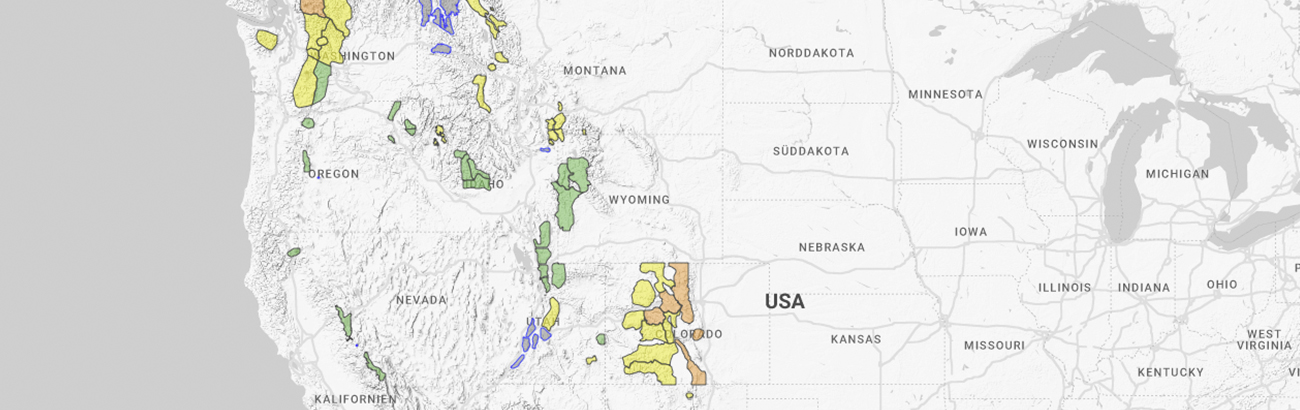
AVALANCHE.ORG
Avalanche bulletins worldwide are organized under the EAWS. You can access all North American avalanche bulletins via an interactive map on the AVALANCHE.ORG website. There, you will also find one of the world’s biggest glossary on the topics of snow and avalanches.
THE INFORMATION PYRAMID
All avalanche bulletins are structured in the same way in the “information pyramid”, which provides the information with increasing detail from the top to the bottom. The general danger level is at the top, beneath which are the dangerous areas and the current avalanche problems. Underneath this you will find information on the snowpack structure, the weather and the forecast for the coming days.
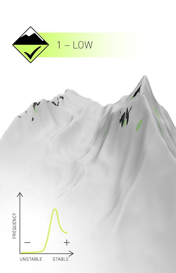
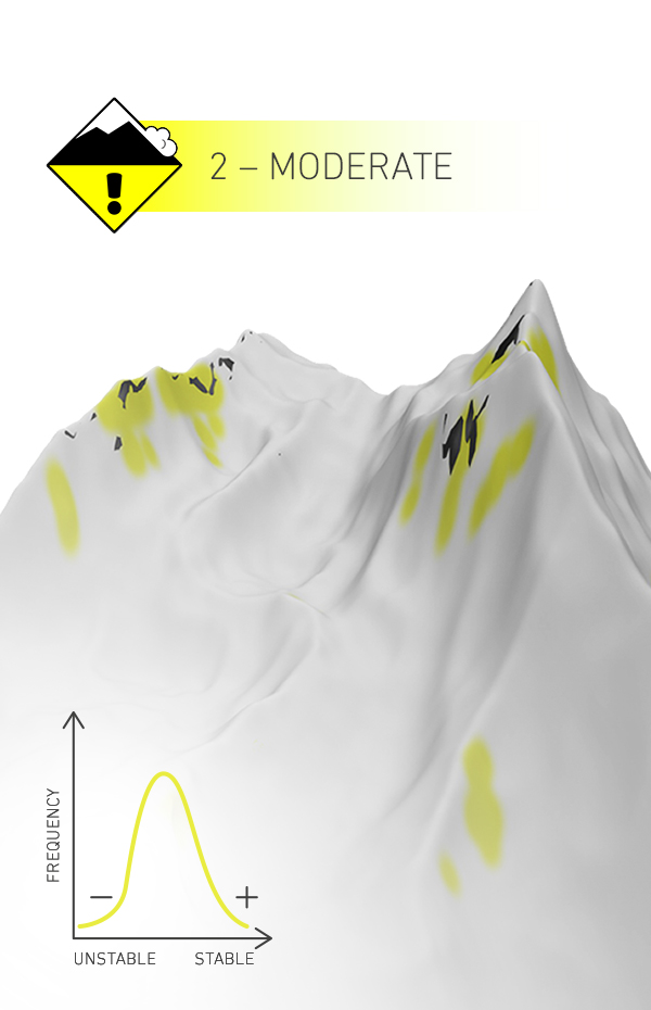
DANGER SCALE
HOW DANGEROUS IS IT?
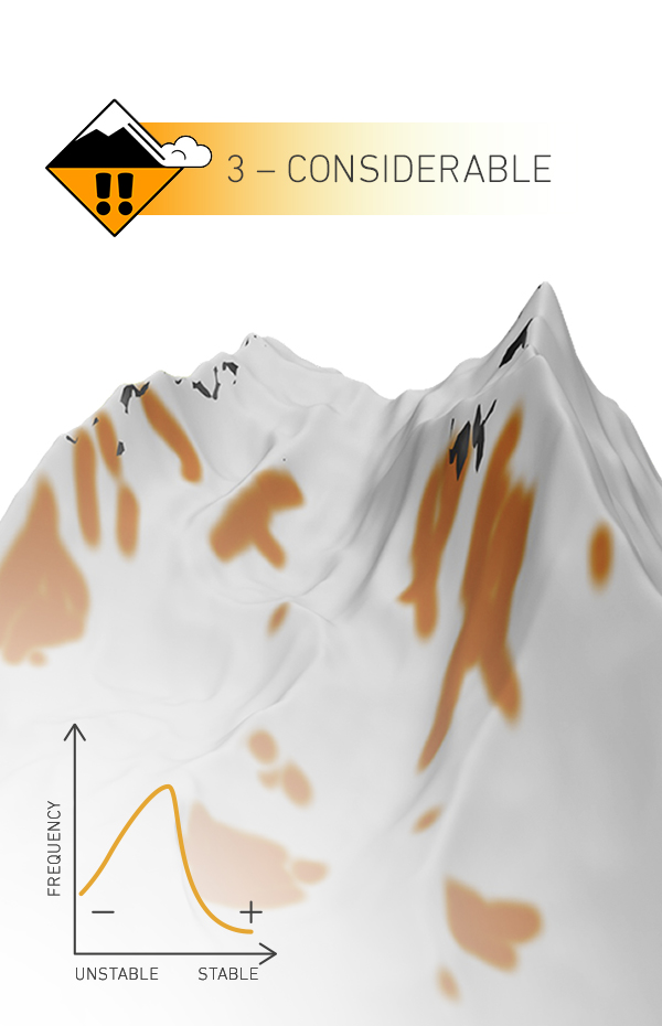
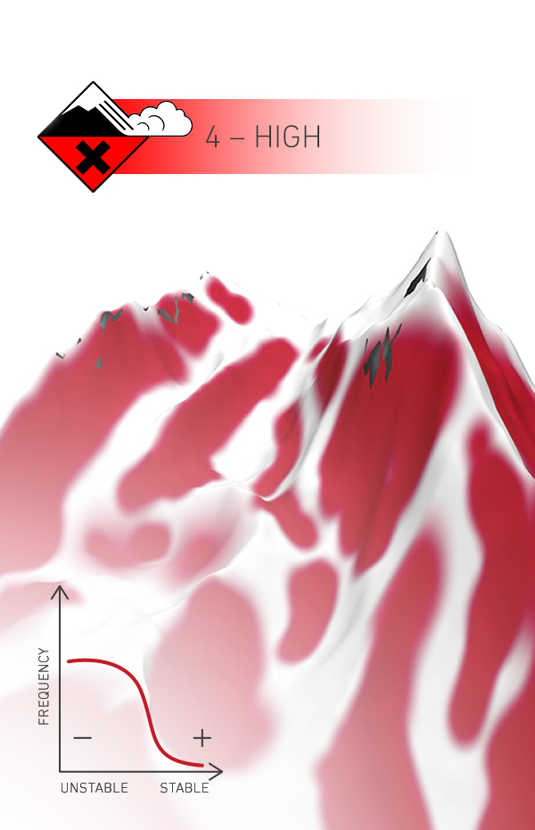
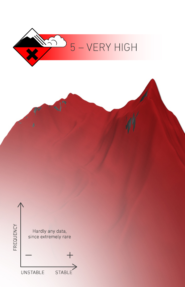
The danger level (1–5) provides an initial rough overview of how dangerous the avalanche situation is. Three characteristics are always taken into account in the assessment of the danger level: the areal distribution of the dangerous areas (extent), the stability of the snowpack (the likelihood of release), and the expected avalanche size.
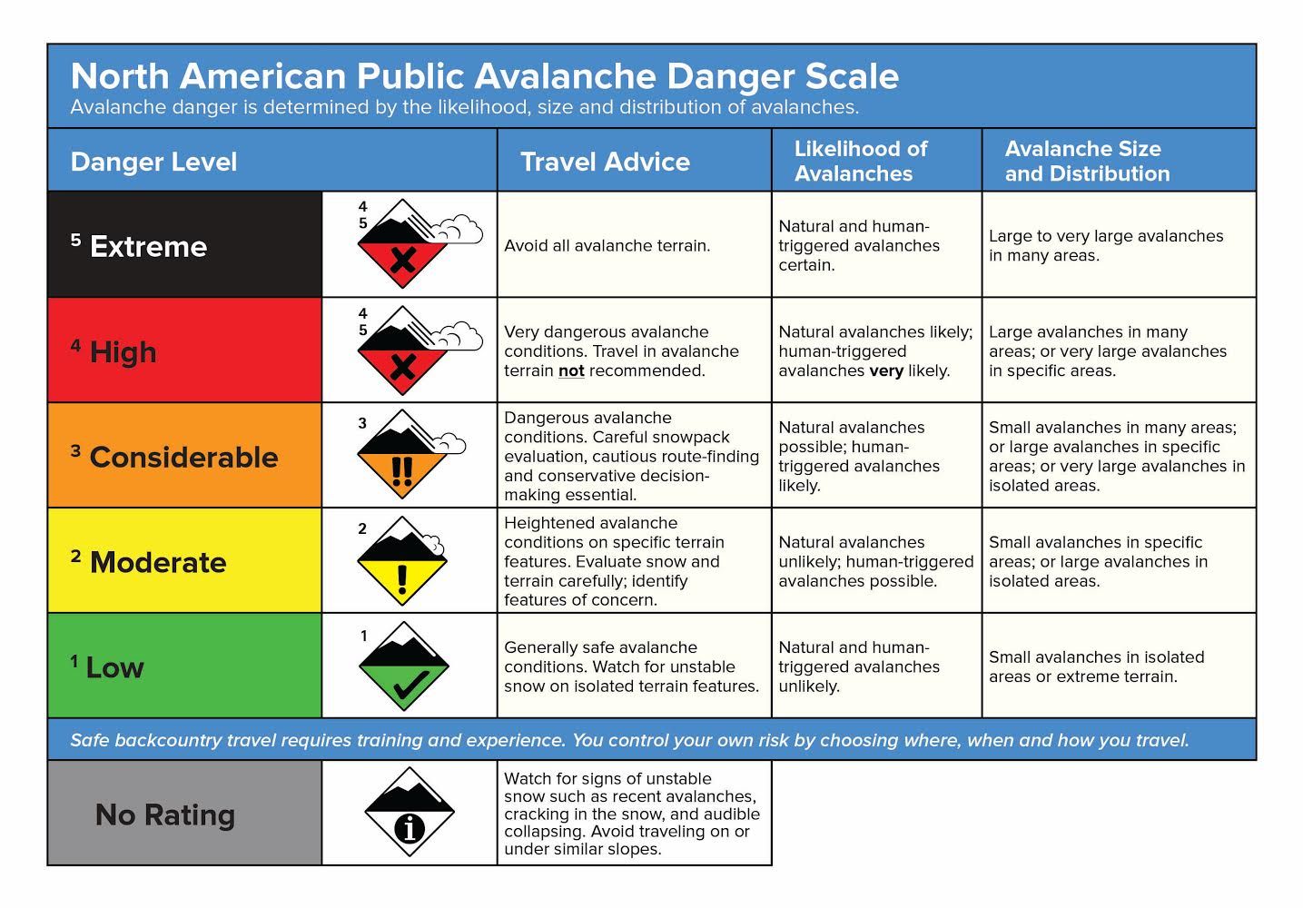
How dangerous is it?
THREE PARAMETERS are key for the danger level: In particular, the frequency of dangerous areas and the stability of the snowpack are of decisive importance. The expected size of avalanches can also play a role.
WHERE IS IT DANGEROUS?
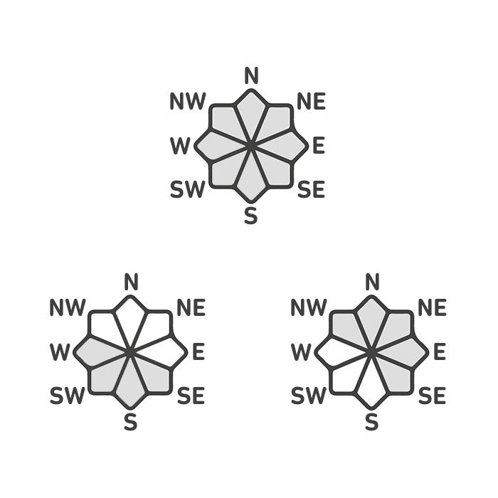
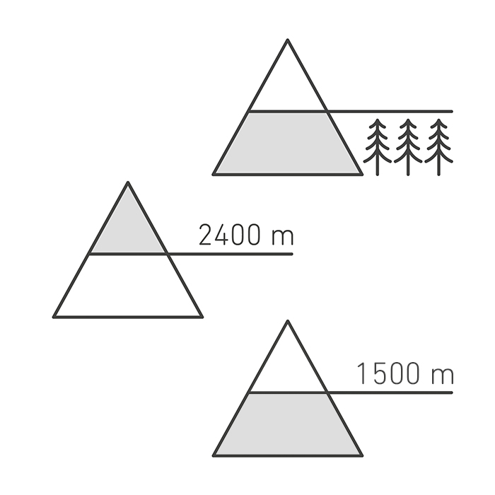
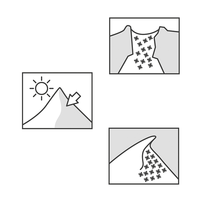
The dangerous areas specify the slope aspect, the elevation and the terrain features where avalanches are possible on a specific day. This information is of the utmost importance for tour planning. Here, it is important that this information is an “AND operation”. This means: If there is a warning about slope aspects west via north to east, an elevation above 2000m, gullies, bowls and ridges, then the dangerous areas are “only” there, i.e. the northern half, above 2000m and in ridge areas and/or gullies and bowls. Avalanches are unlikely on south-facing slopes above 2000m, and just as unlikely in ridge-free areas above 2000m in the northern sector.
WHAT ARE TYPICAL AVALANCHE PROBLEMS?
THE FIVE AVALANCHE PROBLEMS
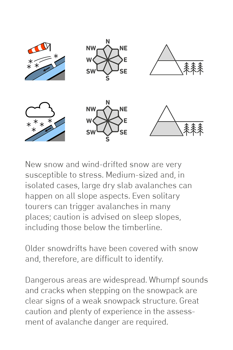
The five typical avalanche problems defined by EAWS are standardized in the avalanche bulletin. They form the third part of the information pyramid and describe typical situations in the mountains: What type and size of avalanche can be expected? What is the characteristic spatial distribution? Where are the weak layers within the snowpack? Why/how will the avalanche be triggered? When and how long is the danger present?
CHECKLIST AVALANCHE BULLETIN
Even though the various avalanche bulletins follow the broad structure of the information pyramid, when looking at the details you will find subtle but important differences. Ideally, the individual avalanche problems will be indicated separately with the corresponding dangerous areas. However, this information must be gleaned from the text in some avalanche bulletins. In such cases, an “auxiliary matrix” can help structure the information.
Here you can collect the information regarding the extent and position of the dangerous area, the expected avalanche size and likelihood of release for each named or relevant avalanche problem, and enter this into the auxiliary matrix. This will result in a more focused picture of which avalanche problem is the “main problem” on the relevant day, where it is likely to occur, and how relevant it is to you.
Here you can download the auxiliary matrix.
AVALANCHE BULLETIN/REPORT
The avalanche bulletin is at the core of tour planning. Here you will find all the important information on danger levels, snowpack structures, current avalanche problems and dangerous area distribution. Of course, correct interpretation of the avalanche bulletin is crucial.
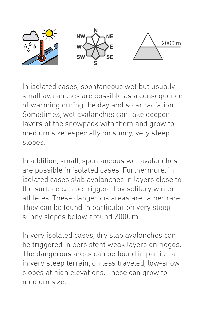
WHICH DANGER LEVEL MATCHES THE DANGERS DESCRIBED IN THIS AVALANCHE BULLETIN/REPORT?
Read the danger description carefully and select the matching danger level! Confirm your selection by clicking “next”.
WHICH DANGER LEVEL MATCHES THE DANGERS DESCRIBED IN THIS AVALANCHE BULLETIN/REPORT?
Read the danger description carefully and select the matching danger level! Confirm your selection by clicking “next”.