No bookmark
VIDEO

ON A SKI TOUR: THE FIVE AVALANCHE PROBLEMS

Avalanche Problems 

New snow, wind-drifted snow, persistent weak layers and wet snow

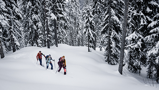
Even in the tour planning stages, the avalanche bulletin provides warnings about the expected avalanche problems in the affected region and, therefore, about dangers on the day in question. When you get to the mountains, the job is now to evaluate how volatile the forecast avalanche problem really is. To do this, you need to know the individual avalanche problems and how they occur. 

The first four avalanche problems listed below are the most relevant for tourers and freeriders: new snow, wind-drifted snow, persistent weak layers and wet snow (temperature problem). The fifth avalanche problem – gliding snow – is less important for winter athletes, because gliding avalanches cannot be triggered but always trigger spontaneously.

Wind-drifted snow problem New snow problem Persistent weak layer problem Wet snow problem Gliding snow problem

Wind-drifted snow problem

The wind-drifted snow problem occurs when the wind forms a “slab” and transports the snow from the windward (exposed) side to the leeward (sheltered) side. The slab does not pose a danger in itself – it also requires a weak layer underneath for an avalanche to occur. 

WHAT? 

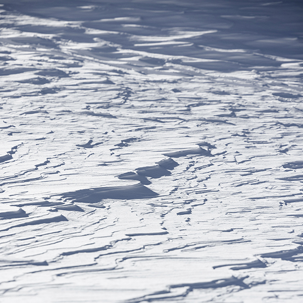
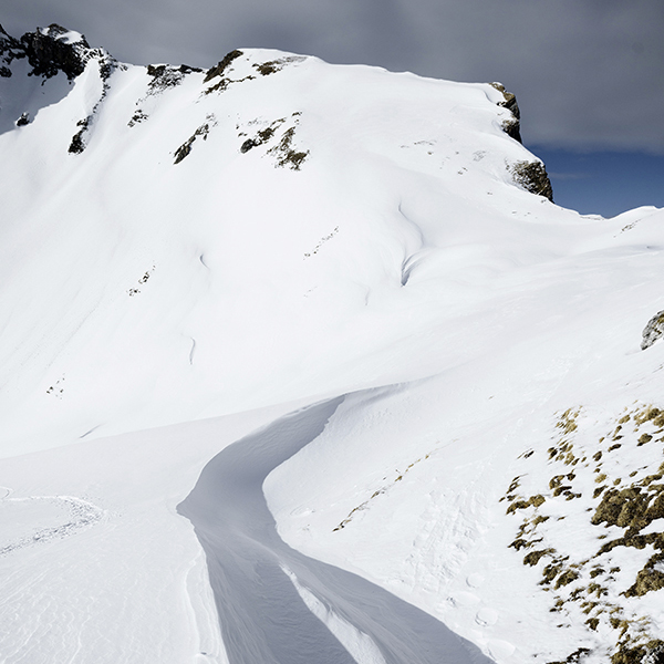
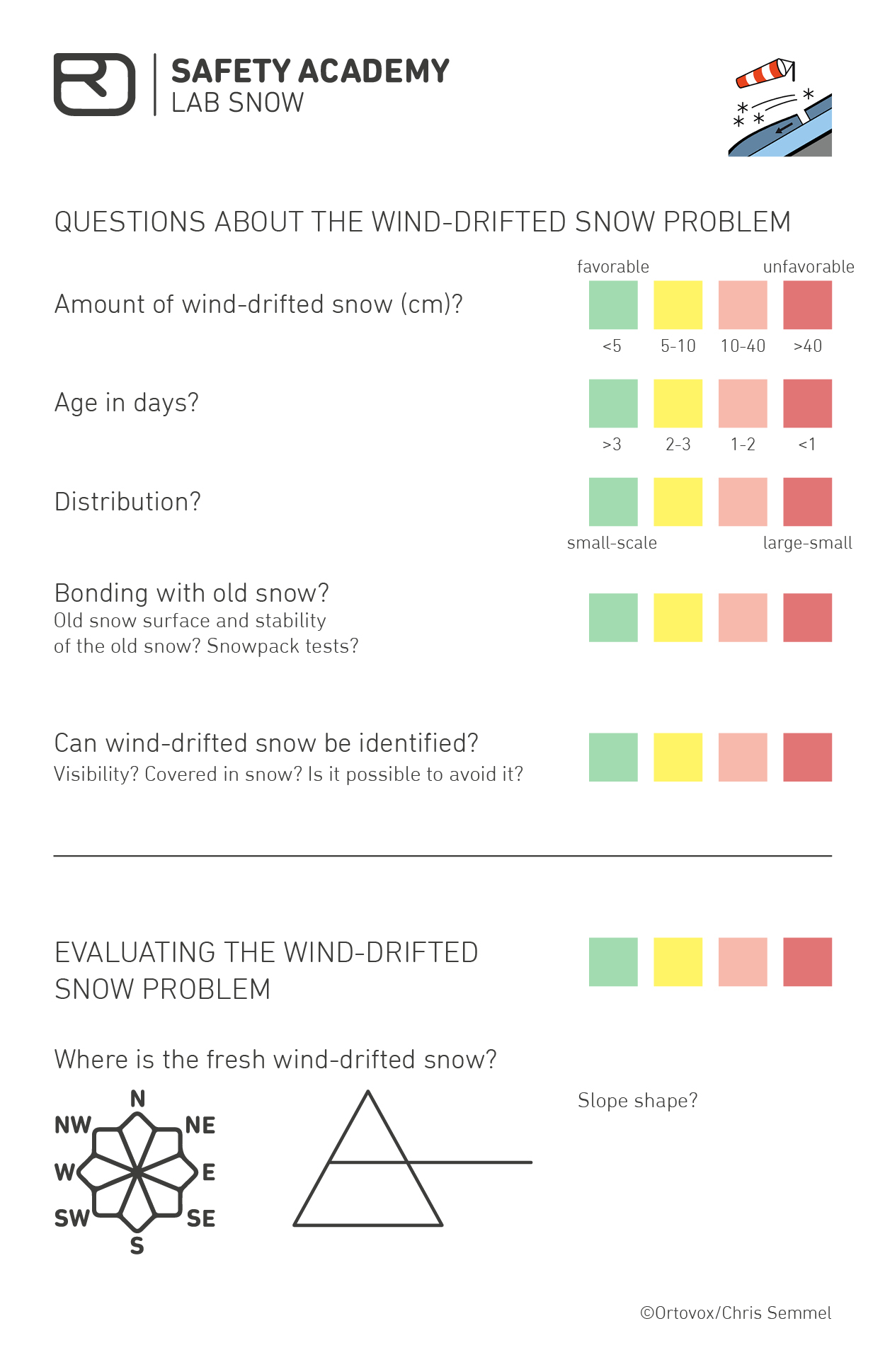
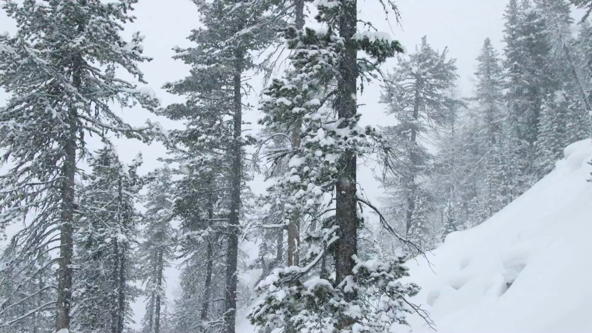
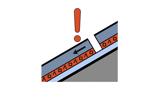
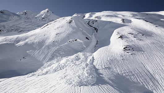
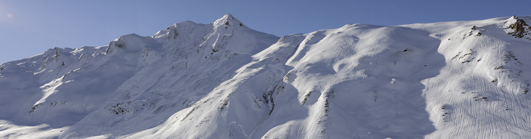
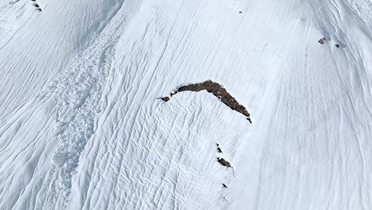
The avalanche problem is related to wind-drifted snow, i.e. when wind moves snow around. This happens during storms, but also in dry periods with strong enough winds to pick up snow from the ground. The newly formed layers add additional load to the existing snowpack, but can also form a weakness within.

Expected Avalanches:

  • Dry-snow slab avalanches 

  • Natural and human triggered avalanches 

  • Remote triggering is not expected 

WHERE? 

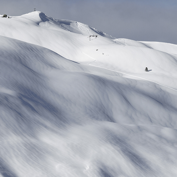
Spatial Distribution: Highly variable, but typically found on sheltered aspects such as in gullies or bowls. Also close to distinct changes in the terrain such as behind ridgelines. More common above treeline. 

Position of weak layers in the snowpack: Usually at the transition to the old snow surface or within the windslab layer due to variation in wind speed and variation during storm cycle, but occasionally also deeper in the old snow cover.
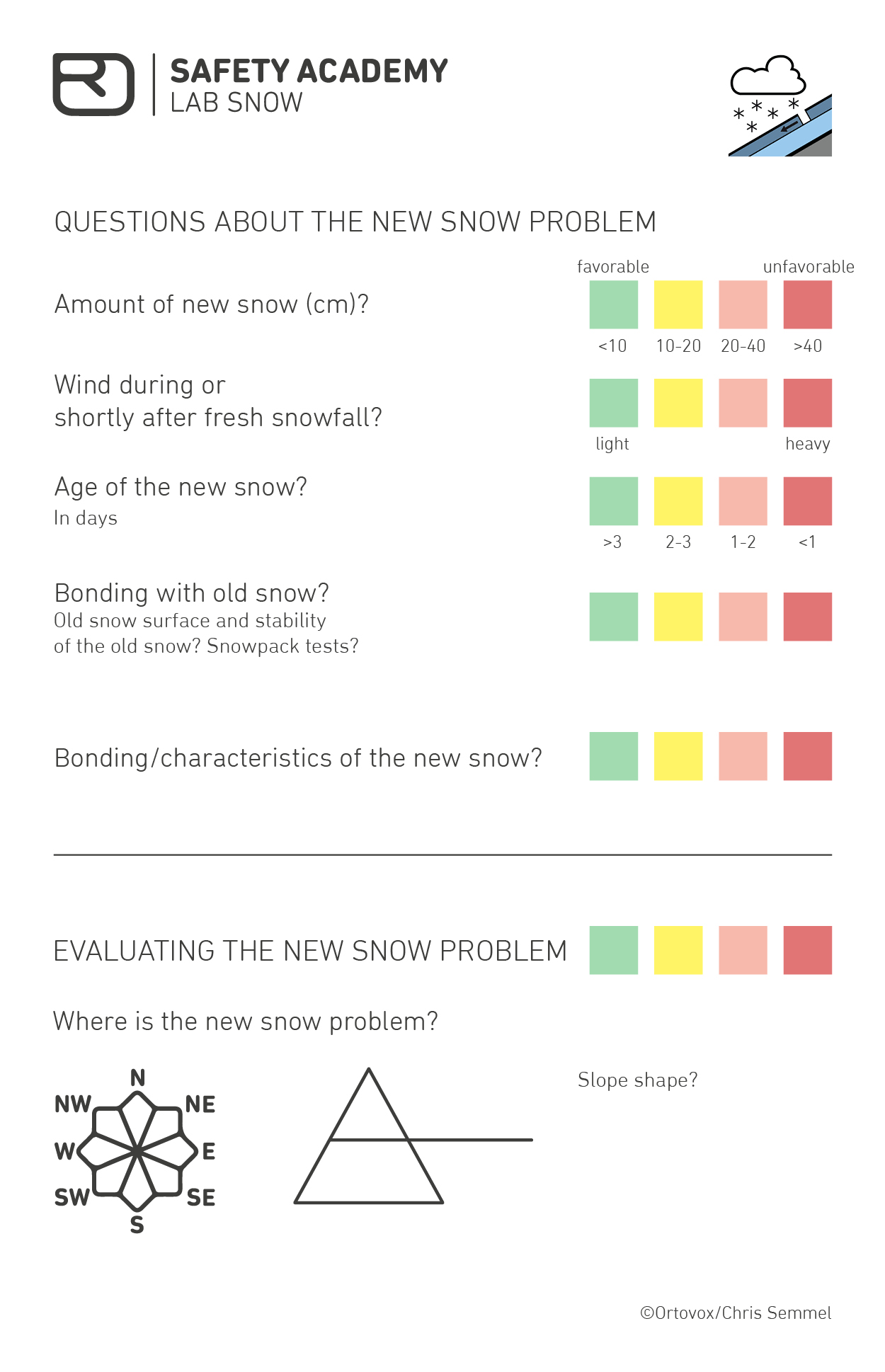
 

WIND SIGNS 

In the mountains, it helps to be able to identify and interpret wind signs. Wind signs in the mountains and on the snow surface help you identify the most recent, prevalent wind direction or fresh wind-drifted snow, even when there is currently no wind. This way, you at least know where the “slab” is. 

Evaluating the wind-drifted snow problem

The following questions help you to evaluate how pronounced the wind-drifted snow problem is; you can get an indication of how precarious the situation really is based on observations made in the mountains As a general rule, an “old” wind-drifted snow problem after a wind phase “heals” very quickly and is often “disarmed” after one or two days.

Here you can download the checklist for the avalanche problem.

NEW SNOW

The new snow problem is when the “slab” is formed predominantly by new snow. But wind could definitely also be at play here. In this case, some bulletins will indicate both avalanche problems, i.e. new snow and wind-drifted snow.

WHAT? 

The avalanche problem is related to current or most recent snowfall. The amount of additional loading by new snow onto the existing snowpack is the crucial factor of the new snow problem. How critical the loading is depends on various factors such as temperature or characteristics of the old snow surface. 

Expected Avalanches:

  • Dry-snow slab avalanches 

  • Dry loose snow avalanches 

  • Natural and human triggered avalanches 

  • remote triggering is typical. 

WHERE? 

Spatial Distribution: Generally widely present and often in all aspects. 

Position of weak layers in the snowpack: Usually at the transition to the old snow surface, but sometimes in the new snow layers and sometimes also deeper in the old snowpack.


Evaluating the new snow problem

The relevant questions about a new snow problem concern the “critical amount of new snow”, which must always be considered in connection with the wind. Often, this evaluation changes as elevation increases, as both snowfall intensity and wind often increase with elevation. As with a wind-drifted snow problem, a new snow problem will generally “heal” after one or two days. And, as always, there is the question of the weak layer – often after the old snow surface under the new snow.

Each question is to be estimated and answered accordingly. Green means “favorable”, yellow “favorable in part”, orange “rather unfavorable”, and red “unfavorable”. 

By going through this checklist, you can ensure no relevant information is missed out. In addition, the questions can be used to collect observations and the individual points can be discussed within the group.

Here you can download the checklist for the avalanche problem.

PERSISTENT WEAK LAYER

The persistent weak layer problem is difficult to identify. As explained in the EAWS definition, the problem – the weak layer – is “hidden” in the old snowpack. This problem is often a long-lasting, faceted weak layer in the snowpack. The danger can last days or weeks. This weak layer in the old snowpack is often “reactivated” by new snow or wind-drifted snow. The additional load or altered slab characteristics can cause the crack in the existing weak layer to suddenly continue propagating.

WHAT? 

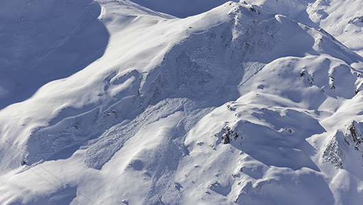
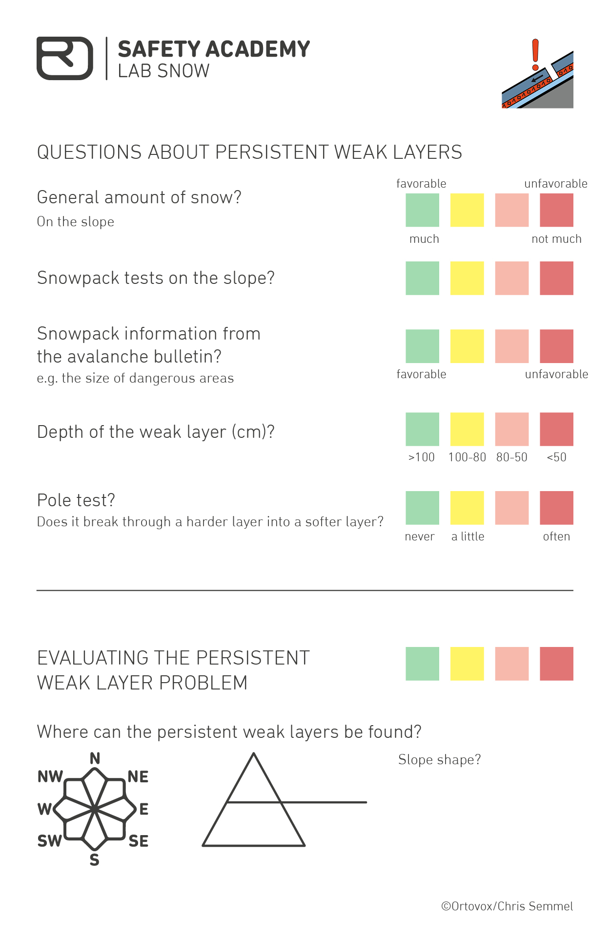
The avalanche problem is related to the presence of persistent weak layers in the old snowpack. These weak layers typically include buried surface hoar, depth hoar or faceted crystals.

Expected avalanche types:

  • Dry-snow slab avalanches  

  • Mostly human triggered avalanches; natural avalanches are rare, mainly in combination with other avalanche problems 

  • remote triggering is typical  

WHERE? 

Spatial Distribution: The avalanche problem can be widespread or quite isolated. It can exist in all aspects, but is more frequent on shady, wind sheltered slopes.

Position of weak layers in the snowpack: Anywhere in the old snowpack, often deep in the snowpack. However, when deeply buried triggering becomes increasingly hard.


Evaluating the persistent weak layer problem

The assessment of a persistent weak layer problem is very complex. The following questions should provide an indication of how volatile the situation is. The challenge of persistent weak layers is that there are only a few indications in open view, i.e. can be identified on the snow surface. You often have to dig a snow profile and take a look at the snow(pack structure).

Each question is to be estimated and answered accordingly. Green means “favorable”, yellow “favorable in part”, orange “rather unfavorable”, and red “unfavorable”. 

By going through this checklist, you can ensure no relevant information is missed out. In addition, the questions can be used to collect observations and the individual points can be discussed within the group. 

Of all of the avalanche problems, the persistent weak layer problem is the most difficult to gauge. Often, a lot of uncertainty remains and the only thing that helps is defensive action.

Here you can download the checklist for the avalanche problem.

WET SNOW PROBLEM or TEMPERATURE PROBLEM

Wet snow problems are fairly easy to gauge. However, due to their density, wet snow avalanches have a lot of potential for destruction. Wet snow avalanches are often labeled as a spring problem, although they can also form in early winter, e.g. due to rain.

WHAT? 

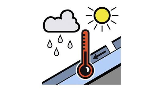
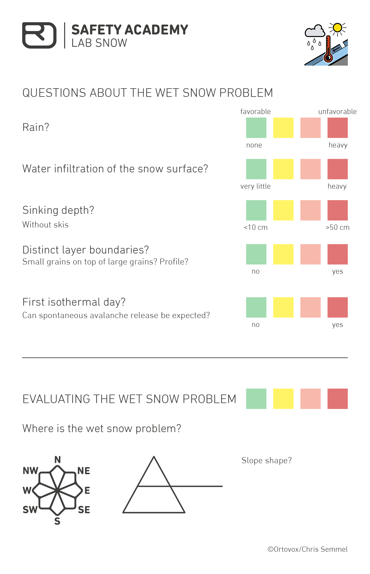
The avalanche problem is related to weakening of the snowpack due to the presence of liquid water. Water infiltrates the snowpack due to melt or rain.

Expected Avalanches:

  • Wet-snow slab avalanches 

  • Wet loose snow avalanches 

  • Mainly natural avalanches 

  • no remote triggering 

WHERE? 

Spatial Distribution: The problem is typically relevant to an elevation which depends on air temperature and humidity. In the case of melting due to solar radiation hazard locations depend on aspect. Rain on snow events affect all aspects. 

Depending on wetness; deeper with ongoing wetting: Depending on wetness; deeper with ongoing wetting.
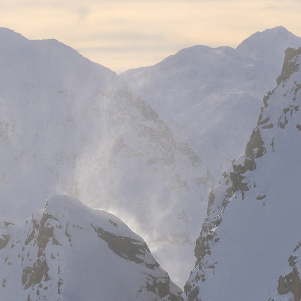
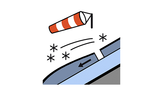
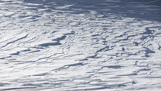
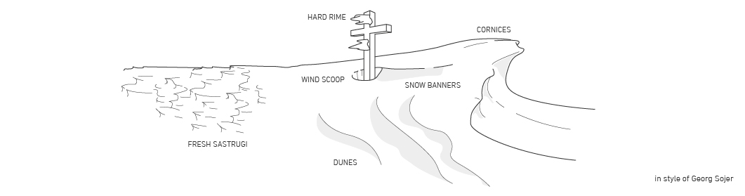
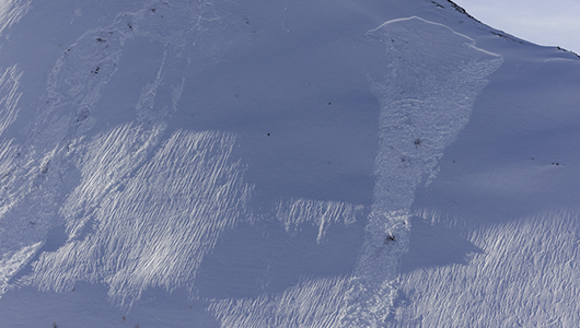
Evaluating the wet snow problem

It is fairly easy to assess a wet snow problem. It is often enough to test and assess the sinking depth and water infiltration. 

The biggest challenge when it comes to wet snow problems is time planning. Because the problem often arises over the course of the day. Even if the snowpack is still frozen and very stable in the morning, this can change relatively rapidly as the temperature increases at different times of the day. This means: If there is a wet snow problem around midday or in the afternoon, you should not go on steep, dangerous slopes again. 

Rain is twice as problematic. Firstly, as rain is very warm for snow, i.e. the snowpack will become moist; secondly, it also adds volume, i.e. is an additional load.  In this case, it can already be very dangerous in the morning or even at night. The elevation and freezing level are key factors here.

Each question is to be estimated and answered accordingly. Green means “favorable”, yellow “favorable in part”, orange “rather unfavorable”, and red “unfavorable”. 

By going through this checklist, you can ensure no relevant information is missed out. In addition, the questions can be used to collect observations and the individual points can be discussed within the group. 

Here you can download the checklist for the avalanche problem.

GLIDING SNOW PROBLEM

Gliding avalanches cannot be triggered artificially and are of little relevance to winter athletes. As a general rule: avoid skiing under “fish mouths”.  In the event of a gliding avalanche, the snow slab mostly glides down steep meadow slopes on a film of water.

Evaluating the gliding snow problem

Gliding avalanches very rarely causes fatalities among winter athletes; however, they are particularly challenging for the avalanche warning commissions. A gliding snow problem is often obvious – they create “fish mouth” cracks. The only question is whether and when an avalanche will release. Warning commissions have to decide when to shut off a street, lift or piste and when not to (yet). 

For winter athletes, the following rule is enough: Stay no longer than absolutely necessary under glide (fish mouth) cracks.

WIND SIGNS

In the mountains, it helps to be able to identify and interpret wind signs. Wind signs in the mountains and on the snow surface help you identify the most recent, prevalent wind direction or fresh wind-drifted snow, even when there is currently no wind. This way, you at least know where the “slab” is.

Fresh sastrugi Snow banners Dunes Cornices Wind scoop with comet tail Hard rime on the summit cross

Current wind signs that show the most recent wind period include: 

Fresh sastrugi – erosion patterns on the snowpack that form on the windward side, i.e. where the wind has “taken the snow with it”. 

Current wind signs that show the most recent wind period include: 

Snow banners – whirled-up snow on ridges and summits that can be seen even from the valley and that indicate the prevailing wind direction and wind strength around the summit. 

Current wind signs that show the most recent wind period include: 

Dunes – treacherous deposits that are caused by drifting snow and indicate wind-drifted snow; the wind has deposited a snow slab here. The flat side of the dune faces the wind, the steeper side is away from the wind. 

Long-term wind signs that show the usual wind direction include: 

Cornices – heavily  compressed deposits of snow formed directly on the sheltered side of a ridge by snow transportation, with a wedge-shaped overhang on the leeward side. 

Long-term wind signs that show the usual wind direction include: 

Wind scoop with comet tail – clearances caused by wind in the snow around an obstacle such as a boulder or summit cross.

Long-term wind signs that show the usual wind direction include: 

Hard rime on the summit cross – solid precipitation that builds up against the direction of the wind in fog and wind.